Subway navigation
Positioning at metro stations becomes much more convenient thanks to the mobile navigator for passengers of public transport, which will quickly get the route to the desired point.
The mobile navigator based on the INP platform helps to quickly get acquainted with the TPU map and saves time at the station, helps to increase the level of travel comfort and passenger loyalty. It helps to create a barrier-free environment for the movement of people with disabilities, visually impaired and blind passengers.
Описание
Moscow is a prime example of not only a dynamically developing "smart city", but also a technological transport hub. Public transport is becoming more popular and in demand, and the infrastructure being created for this purpose is constantly expanding, making it more ambitious and difficult to navigate.
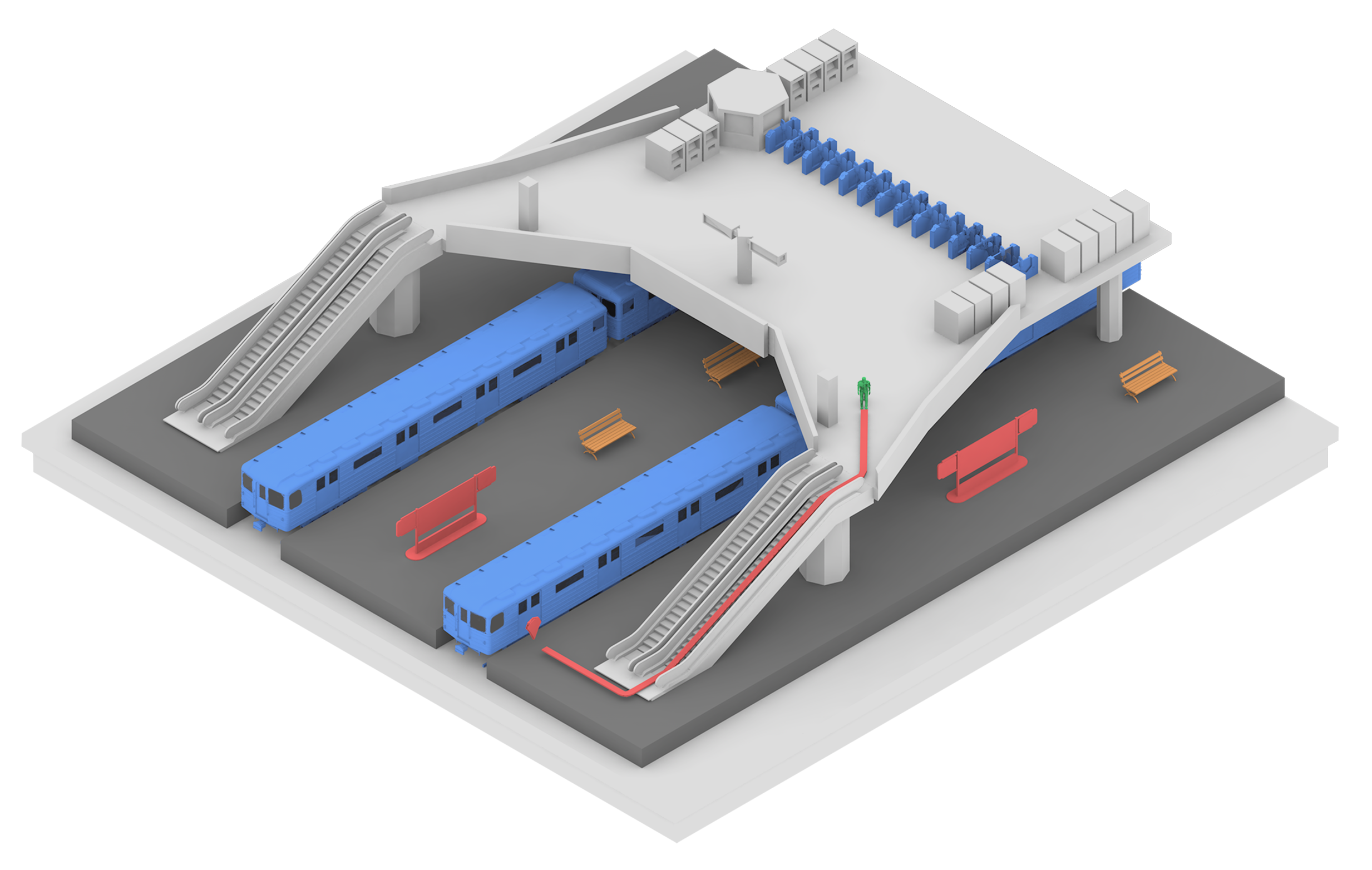
The Moscow Metro is the backbone of the capital's transportation system. That is why, as part of the pilot project, the Indors Navigation team implemented its geographic information system in the Tsaritsyno transport hub, implementing a convenient navigator for passengers.
The digital twin of a subway station
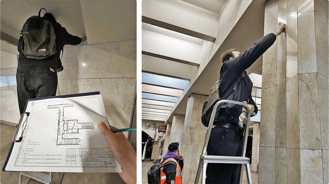
The Indoors Navigation team has created an exact digital copy of the entire Tsaritsyno transit hub with a detailed three-dimensional map of the metro station, MCD, commuter trains, all crossings and stops. More than 100 positional sensors have been installed at the station.
WEB control panel
The service is managed from the web-based control panel, where you can quickly change routes, update information about facilities, or inform passengers with an address message. The Indors Navigation geoinformation system provides seamless navigation both at underground metro stations and at the MCD and MCC street stations, continuously accompanying the user.
AR navigation
The service also has the ability to follow a route in augmented reality mode. By scanning a special marker, the user can see the route through the phone's camera in real space. The augmented reality service can display advertising content with 3D graphics.
Navigator for the visually impaired and blind
The passenger navigator has a special mode for people with limited mobility, including the visually impaired and blind. You can build a special route that will lead through the designated passageways without steps, elevators and ramps. A special interface with voice acting and voice prompts along the route is designed for the visually impaired. At any time, the user can request help by clicking on their location. And specially installed sensors with sound signals will help them accurately determine their location and follow to the end of the route.
Statistics and analytics of movements in the subway
The geographic information system uses visit statistics to determine the object's points of attraction, build a heat map, and visualize popular routes. The metro administration receives time-bound data on crowded areas and congested sections and sees the movement of users online.
Integration of the navigator into other applications
Due to the open API of the platform and the Indoors SDK, the navigator's functionality can be quickly integrated into other mobile applications, such as Metro or Moscow Transport. The system is quickly implemented and easily scaled due to simple installation without damaging the surface and supports a wide range of mobile devices. The use of vertical IoT location in public safety
Other projects
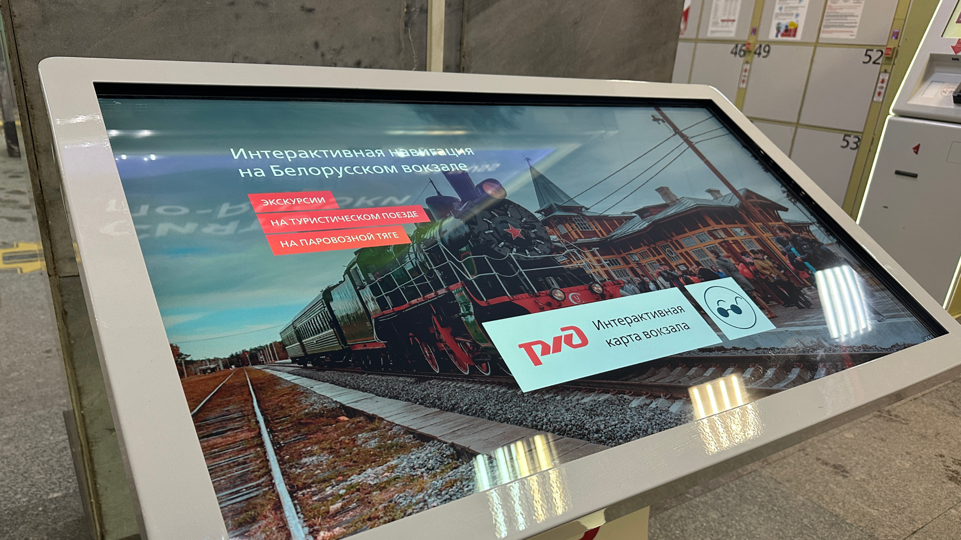
Interactive terminals at Russian Railways stations
The Directorate of Railway Stations (JV), together with Indoors Navigation, has introduced an additional service — interactive terminals with 3D maps at 15 Russian Railways stations.
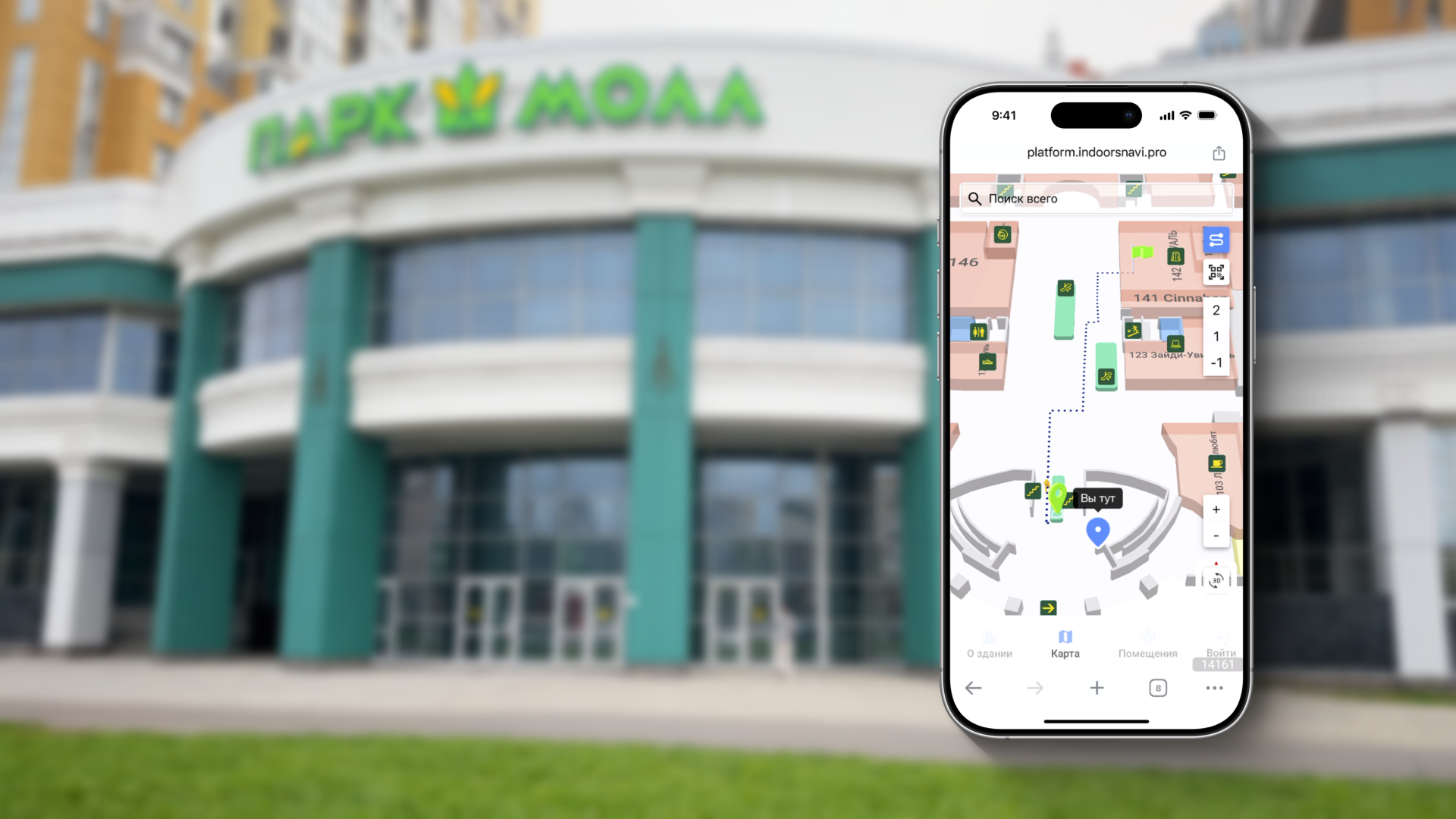
Interactive map with QR navigation in the Park Mall shopping mall
The company Indoors Navigation has successfully implemented an interactive navigation system based on the INP platform in the shopping and entertainment complex "Park Mall" in St. Petersburg.

Navigation at the Kazan exhibition Digital Week 2023
Indoors Navigation Company took part in the Kazan Digital Week exhibition, where it demonstrated an innovative solution based on the Indoors Navigation Platform using augmented reality (AR) technologies.
Our address
El Barsha 1, El Barsha, Hadaek Muhammad Bin Rashid, emirate Dubai