Subway navigation
Every year, more new stations and transfer hubs are being built, and transport routes around the metro are being combined: the MCC, TPK, and MCD. Passenger traffic has increased by 19% over the past 10 years.
Passengers often do not know where the passage they need is, the exit to the street or bus, or the passage to the transfer. The search is carried out only by visual navigation signs. In the modern world, this is not the most optimal way, which consumes a lot of passengers' time, thereby delaying their stay at stations and reducing the capacity of the subway as a whole.
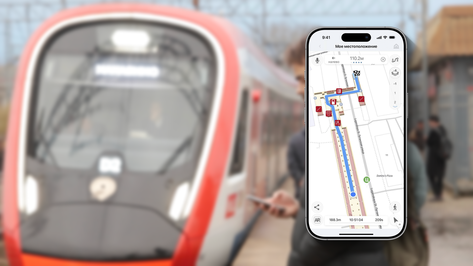
The introduction of internal navigation will allow passengers to provide a detailed station map on a mobile device with the ability to plot a route to the desired point (exit, crossing, stop) while still in the train carriage, and follow it in navigator mode.
The digital twin of TPU and the cartographic service of subway crossings simplify the management of the facility and increase passenger comfort.
Advantages of implementing positioning on the construction site:
Due to new services, and therefore the popularization of public transport
Analysis of movements and tracking of passenger flows (who uses what kind of transport, at what time, at which stops they enter and exit, where and where they transfer) during the comprehensive implementation of the service in transport
Thematic cases in our portfolio
Subway navigation
Positioning at metro stations becomes much more convenient thanks to the mobile navigator for passengers of public transport, which will quickly get the route to the desired point.
Our address
El Barsha 1, El Barsha, Hadaek Muhammad Bin Rashid, emirate Dubai