Navigation at the exhibition
The largest exhibition complexes use modern technologies to attract visitors and participants, strive to make visiting exhibitions more comfortable and their management more convenient. All this points to the need to introduce modern geographic information systems for indoor navigation.
The use of AR navigation on exhibition sites makes visits not only more exciting and opens up new opportunities for visualizing information about exhibitors, but also helps to find the right booth faster.
The regularly changing layout of the exhibition spaces requires digitalization of the exhibition complex, as well as the introduction of a geolocation platform with navigation functions for pavilions and stands, in which you can quickly change their location and description.
A mobile application with internal navigation allows you to navigate and find the exhibition stand you are interested in, a place for lunch, and even a car in the parking lot!
Advantages for exhibition centers:
Reaching the world standards of exhibition work, increasing the loyalty of guests
Reduction of operating costs and its digitalization
Up-to-date statistics on movements around the exhibition and heat maps
Placing ads using the geo-contextual advertising module
Augmented reality to showcase the content of the exhibitors

Optimizing the work of employees through the exhibition staff tracking system
Advertising on the Internet by mac addresses and connecting social networks
Thematic cases in our portfolio

Navigation at the Kazan exhibition Digital Week 2023
Indoors Navigation Company took part in the Kazan Digital Week exhibition, where it demonstrated an innovative solution based on the Indoors Navigation Platform using augmented reality (AR) technologies.
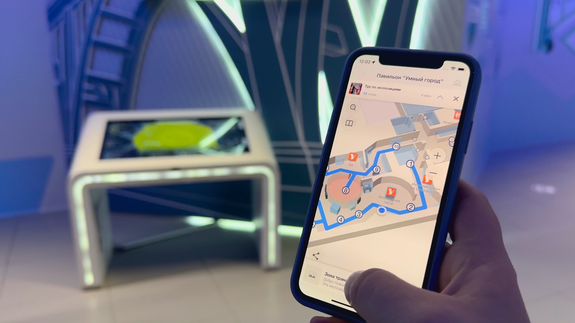
Interactive map and museum guide of the Smart City Pavilion
In cooperation with the Moscow Innovation Cluster (MIC) and the Moscow Department of Information Technology (DIT), Indoors Navigation has implemented a project to digitalize the Smart City pavilion at VDNH.
Our address
El Barsha 1, El Barsha, Hadaek Muhammad Bin Rashid, emirate Dubai