Stadium navigation
In the modern world, stadiums are no longer just a platform with stands for sporting events. They become part of the show, amaze with new technologies and large-scale cultural events.
The stadium's digital twin based on GIS Indors Navigation provides not only a modern navigation service, but also simplifies the operation of the facility with frequent layout changes and provides the administration with the necessary metrics in the web control panel.
For example, which doors are open, which floors have elevators, what temperature is in different rooms, what mode is the fire safety system in, where is the security and other metrics of the stadium's operational processes.
When holding concerts or exhibitions, it is important to quickly transform the space each time and provide visitors with an up-to-date map with a new location of the spectator areas and routes to them.
Benefits for the administration:
Reducing the costs of operating a sports facility and digitalizing it.
Consequently, there is an increase in the loyalty of the audience, their number and the prestige of the sports facility.
The new geocontext advertising service generates additional revenue through newsletters and promotional messages to visitors.
Analysis of the behavior and distribution of spectator flows in the stadium, heat maps of the facility.
A modern tracking system for the movement of employees around the stadium.

Client orientation
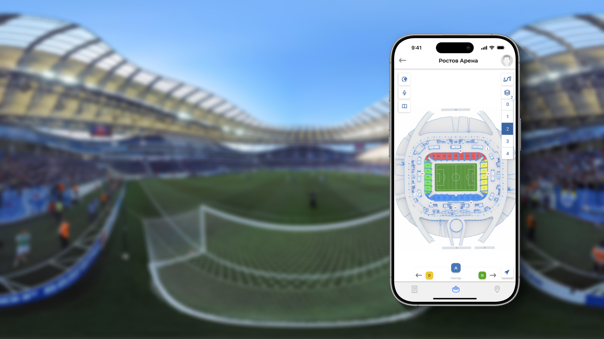
The introduction of a geographic information system at the stadium will provide a high level of service to visitors and solve the problem of rapid orientation at the sports facility, ending wandering through sectors and stands once and for all.

Advantages for visitors
- A detailed map of the stadium is available on your mobile phone, with the ability to plot a route to the desired exit to the podium and navigate it like in a navigator
- Quickly determine your location on the territory of a sports facility
- The ability to find an object of interest in game mode using augmented reality hints — AR navigation in the stadium
- Direct notification of events at the stadium with reference to your geo-location
- Displaying friends on the map of a sports facility
Thematic cases in our portfolio
Navigation in the stadiums of the 2018 World Cup
Indoors Navigation has implemented an integrated navigation and information system (NIS) at seven stadiums of the FIFA World Cup in Russia
Our address
El Barsha 1, El Barsha, Hadaek Muhammad Bin Rashid, emirate Dubai